← All tripsCalifornia

Death Valley National Park

The lowest, driest, hottest place in North America — and one of the most beautiful.

My picks
📅 Fri Jan 15 – Mon 18, 20273 nightscamping at Echo Canyon Road, site E1Join this trip →

Death Valley — MLK weekend, January 2027

Three nights camped on our own gravel pad off Echo Canyon Road, a few miles from Furnace Creek, in the one season when Death Valley is comfortable: sunny 60s by day, dark skies and cold, silent nights. Ben’s family from the 3rd grade DLI class is in, camping at Furnace Creek Campground ten minutes from our site, and there is room at camp for more.

When

Fri Jan 15 – Mon 18, 2027

3 nights ·

+ Add to calendar

Room at camp

People
up to 12
Vehicles
up to 3

E1’s limits. Vehicles are the tight one — tell Aaron what you’re driving. If we outgrow it we add a second site nearby.

Roughly what it costs

  • Campsite E1$10 per nightFor the whole site — split across everyone. Three nights is $30 total.
  • Park entrance$30 per vehicleGood for 7 days; pay at a kiosk or the visitor center. Free with an America the Beautiful pass.
  • Gas and foodyour ownFill up in Baker; Shoshone has the last gas before the park. We cook at camp; one dinner at The Ranch is on the table.
  • Cold-weather sleeping setupvariesOnly if you don’t own a 20°F bag and pad — ask about spares.

This is the cheap trip: the site is $10 a night for all of us.

Home base · campsite

Echo Canyon Road, site E1

Backcountry Roadside Camping, Echo Canyon Road, site E1 — a reserved, designated dispersed site: a private gravel pad on a dirt road that we booked, with nothing at it. Echo Canyon Road leaves CA-190 about 4.6 miles east of the Furnace Creek Visitor Center; E1 is the first site, one mile down the gravel road and the closest one to pavement. It is a 70-ft pull-through pad for up to 12 people and 3 vehicles, with no water, toilets, shade or fire ring. Our nearest — and only — neighbor is half a mile away. Furnace Creek (visitor center, store, fuel, restrooms, showers for a fee) is about 10 minutes back down the road.

Open in maps

If you’re joining: E1 is reserved through recreation.gov ($10/night, up to 6 months ahead) and holds 12 people and 3 vehicles, so joiners can share our site — just tell Aaron how many people and cars. If we outgrow it, Furnace Creek Campground is in its reservable season and Sunset and Texas Springs campgrounds next to it are first-come, first-served.

Affects our dates · checked 2026-09-17

  • Titus Canyon Road closes for repairs October 1, 2026 through September 30, 2027. The park's most popular backcountry drive is only temporarily open until then, and may close on individual days. source
  • Flood damage still affects two paved roads. North Highway has loose gravel and missing shoulders; southern Badwater Road below Badwater has soft shoulders, large drops at the edges and unpaved stretches. source

Getting in

Fri Jan 15: drive from the LA/OC area — I-15 north to Baker, CA-127 north through Tecopa and Shoshone to Death Valley Junction, then CA-190 west to Furnace Creek (Shoshone is about an hour from Furnace Creek). Fill the tank and buy ice and groceries in Baker; Shoshone has a small store and the last gas. Pay the entrance fee at the visitor center or an automated kiosk. Reach camp with an hour of daylight; sunset is around 4:50 p.m.

Getting out

Mon Jan 18 (MLK Day): pack up in the morning, a last stop or two, then home the way we came — CA-190 east to Death Valley Junction, CA-127 south through Shoshone to Baker, and I-15.

Dates that matter

  1. Wed Jul 15, 2026The 6-month recreation.gov window for Furnace Creek Campground on our nights opened — already open and filling. Ben’s family is there; book it now if you’d rather have a developed campground (water, flush toilets) 10 minutes from our site.
  2. Fri Jan 15, 2027Arrive with an hour of daylight (sunset ≈ 4:50 p.m.). Pay the entrance fee at the Furnace Creek Visitor Center or a kiosk on the way in; there are no staffed entrance stations.

What we might do

No fixed schedule — these are the 10 things worth the trip, ranked by popularity. Tap one for the full card; Add to my picks builds a list you can send Aaron.

My picks

What these dates mean

Weather

January at Furnace Creek averages a 67°F high and 40°F low. Expect sunny, still days that feel warm in the sun and cold the moment it sets. Rain is rare but a winter storm can close dirt roads.

Nights

We are camping at about sea level with no shelter: plan on upper 30s at night, possibly colder. A 20°F sleeping bag, an insulated pad and a warm hat make it a great night instead of a long one.

Daylight & dark sky

Sunrise around 6:50 a.m., sunset around 4:50 p.m. Death Valley is a Gold Tier International Dark Sky Park and January nights are long — bring binoculars or a camera for the Milky Way.

Can my car get to camp?

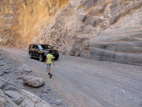
E1 is the easy site. It is one mile in on graded gravel, and NPS rates the lower canyon as needing moderate clearance at minimum — a crossover or SUV driven carefully is fine. The “high clearance, 15-inch rims, 4WD encouraged” rule quoted on recreation.gov is for the sites farther up the canyon (E2–E9). No trailers or big RVs; never drive off the roadbed. Sedans can park at Furnace Creek and ride the last mile with us.

Camp life: water, toilets, trash

There is no water and no toilet at camp. Bring at least a gallon of water per person per day and refill at the Furnace Creek Visitor Center. Nearest flush toilets are at Furnace Creek, 10 minutes away; at camp it is a “wag bag” (a sealable human-waste bag from any outfitter — we’ll have spares) or a cat-hole at least 200 yards from camp. Showers are at The Ranch for a fee. Pack out every scrap of trash; generators are not allowed in the backcountry.

Crowds & closures

MLK weekend is a busy winter weekend at Furnace Creek, but our site is private by design. Titus Canyon Road is closed for repairs through September 2027, and the south end of Badwater Road still carries flood-damage warnings; the Top 10 and our route in are unaffected. Check the park’s conditions page the week of the trip.

Bring

Want to come?

This is an easy trip to say yes to: one drive, one campsite that fits a dozen people, and days spent on short walks between some of the strangest landscapes in the country. Come for all three nights, or just Saturday and Sunday — the site is booked either way.
  1. Coordinate with Aaron — how many people, which nights, and what you’re driving (E1 allows 3 vehicles).
  2. Sort a cold-weather sleeping setup and your own water and food (see Bring); ask about spare gear.
  3. Tap Add to my picks on what you’d want to see, then send Aaron the link — it shapes which days we go where.
Add to calendar

Who’s in so far

  • Aaron’s family — all three nights at Echo Canyon site E1
  • Ben’s family (3rd grade DLI class) — camping at Furnace Creek Campground, 10 minutes from our site

Questions people ask before saying yes

Roughly what will this cost me?
Almost nothing beyond gas: the site is $10 a night for all of us, the park is $30 per car for the week, and the rest is groceries. If you need a winter sleeping bag, that is the one real purchase — or ask about spares.
Do I have to camp on gravel? Is there a bed option?
Yes, there is. Furnace Creek Campground (reservable, water, flush toilets) is 10 minutes from our site — Ben’s family is camping there — and The Ranch at Death Valley and The Inn have rooms at the same junction. Sleep there and join us for the days.
Can I come for just the weekend?
Yes — Saturday and Sunday are the full days. Drive in Friday evening or Saturday morning and leave Sunday night or Monday.
Is it kid-friendly?
Yes — see the January 2025 photos: dunes, salt flats, Golden Canyon and checkers on the porch at The Ranch. Cold nights are the only real consideration; kids need proper bags too.
What car do I need?
For E1, a crossover or SUV driven carefully; sedans park at Furnace Creek and ride in with us. Nothing in the Top 10 needs 4WD.
How fit do I need to be?
Not very. Most of the Top 10 are short walks from the car; the longest we’d likely do is Mosaic Canyon or Golden Canyon at 3–4 miles round trip. Dante’s View and Zabriskie Point are drive-ups.
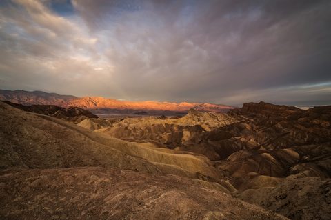
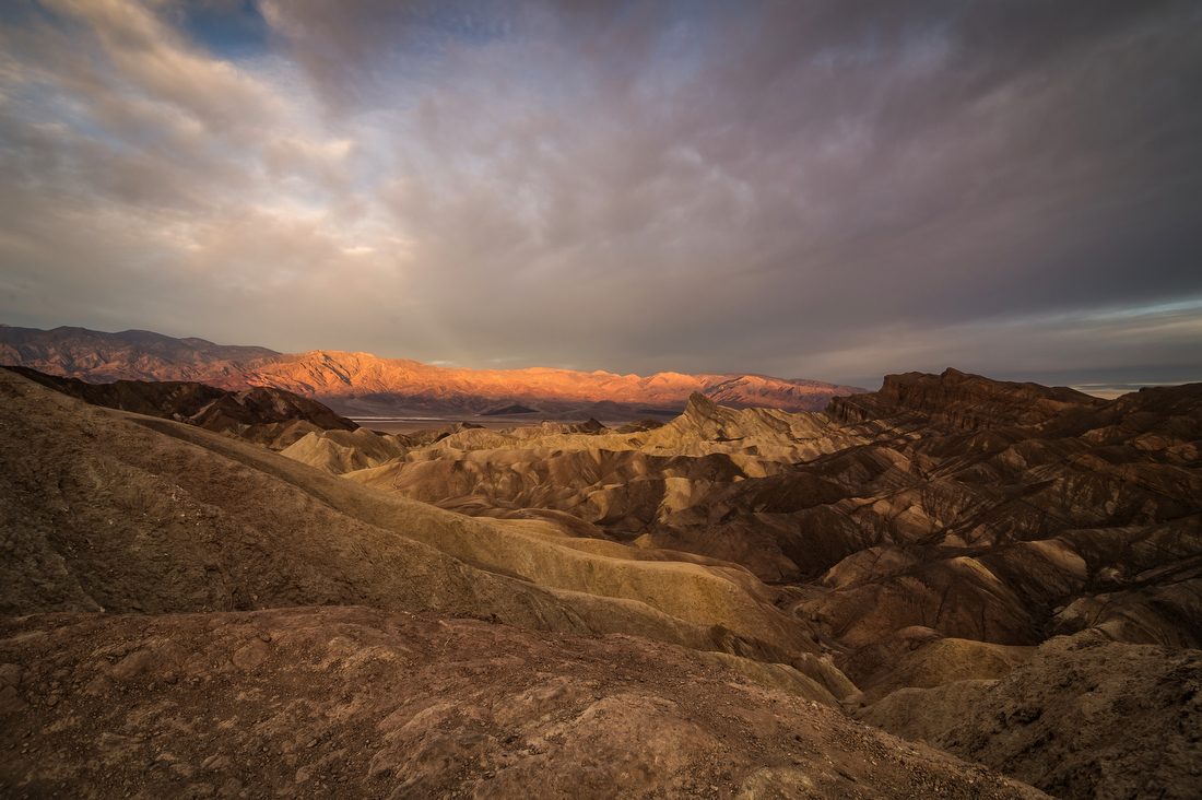
Sunrise light on the golden badlands at Zabriskie Point, Death Valley

Death Valley National Park

The lowest, driest, hottest place in North America — and one of the most beautiful.

Photo: National Park Service / Kurt Moses · PD

Entrance fee
$30/vehicle, 7 days
No staffed entrance stations — pay at a kiosk, the visitor center, or online
Best months
November–March
Spring is busiest; late October and February are the sweet spots
Elevation range
-282 ft to 11,049 ft
Badwater Basin to Telescope Peak, in sight of each other
Park size
3.4 million acres
Largest national park outside Alaska; over 93% roadless wilderness
Time zone
Pacific (PT)
Cell service
Essentially none
Spotty at Furnace Creek and Stovepipe Wells only; free Wi-Fi at the visitor center
Dark sky
Gold Tier Dark Sky Park
The highest International Dark-Sky Association rating
Reservation needed?
No
No timed entry. Only campsites are reserved.

Current conditions · checked 2026-09-17 · 6 items

  • affects our dates Titus Canyon Road closes for repairs October 1, 2026 through September 30, 2027. The park's most popular backcountry drive is only temporarily open until then, and may close on individual days. source
  • affects our dates Flood damage still affects two paved roads. North Highway has loose gravel and missing shoulders; southern Badwater Road below Badwater has soft shoulders, large drops at the edges and unpaved stretches. source
  • Scotty's Castle and Bonnie Clare Road remain closed after the 2015 flood and a later fire. No access is permitted, including on foot; the NPS says the reopening date is unknown. source
  • Darwin Falls Road is closed, likely until summer 2027 — the road is "completely gone in many places." Hikers may park on the CA-190 shoulder and walk in. source
  • Seasonal campgrounds are still closed as of mid-September 2026. Texas Springs, Sunset and Stovepipe Wells reopen in late fall; Furnace Creek is first-come for the summer. Emigrant is closed indefinitely (water system), and Saline Valley closed after a wildfire on September 15, 2026. source
  • The 2026 superbloom is over. Low-elevation flowers have set seed; higher elevations have scattered blooms. Superblooms average once a decade — 2026, 2016, 2005 and 1998. source

Why go

Death Valley's superlatives are all literally true. It holds the world record air temperature — 134°F, set at Furnace Creek on July 10, 1913 — and the lowest ground in North America at 282 feet below sea level, in sight of Telescope Peak 11,049 ft above.

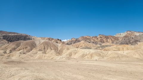
What surprises first-timers is the variety. Within an hour of Furnace Creek you can walk a salt pan, drive hills stained red and green by volcanic minerals, scramble a polished marble slot canyon, and circle a 2,000-year-old crater. Over 93% of its 3.4 million acres is roadless wilderness, and it is a Gold Tier Dark Sky Park.

It is also remote: no cell service across most of the park, three gas stations, and help hours away.

Best for

Scenic drivingPhotographyStargazingDesert geologyCanyon hikesWinter warmth

Don’t miss

  1. Sunrise at Zabriskie Point, when the badlands turn gold
  2. Walking out onto the salt polygons at Badwater Basin
  3. Artists Drive in late afternoon, when the mineral colors peak
  4. The Mesquite Flat dunes at sunset, then again after dark for the Milky Way
  5. The 5,575-foot drop from Dante's View to the valley floor

Full details in Top 10.

When to go

Best

Spring

Mar–May

Highs 82–100°F · Lows 55–73°F

The NPS calls spring "the most popular time to visit." Low-elevation wildflowers run mid-February to mid-April, moving to 3,000–5,000 ft by late April. Everything is open and everything is busy — Furnace Creek Campground books to capacity most nights. By May the valley is already scorching.
Hard

Summer

Jun–Aug

Highs 110–116°F · Lows 81–88°F

Survivable by car, not on foot. NPS posts "hiking not advised after 10 am" on every low-elevation trail. Overnight lows stay in the 80s. The mountains are the exception — Wildrose and Telescope Peak are the summer hikes. Several campgrounds close; Furnace Creek shrinks to 41 first-come sites.
Good

Fall

Sep–Nov

Highs 77–106°F · Lows 48–76°F

September still reaches 106°F, but the NPS notes "autumn arrives in late October, with warm but pleasant temperatures." Late October and November are arguably the best weeks of the year — seasonal campgrounds reopen, crowds are lighter than spring, and the light is long.
Best

Winter · our trip

Dec–Feb

Highs 65–73°F · Lows 38–46°F

Cool days, chilly nights, rare rain, and snow capping the Panamints above the salt flats — the NPS calls it "especially beautiful." Perfect valley-level hiking weather. Trade-offs: freezing nights at camp, short daylight, and the high country often snowed in. Ranger programs run mid-November to mid-April.

Top 10 natural attractions

Ranked by popularity. Distances and times are official park figures where available. Tap Add to my picks to build a list you can send the host.

Badwater Basin1

Badwater Basin

ViewpointEasyNo permit
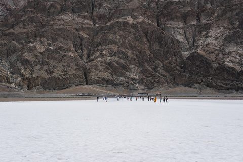
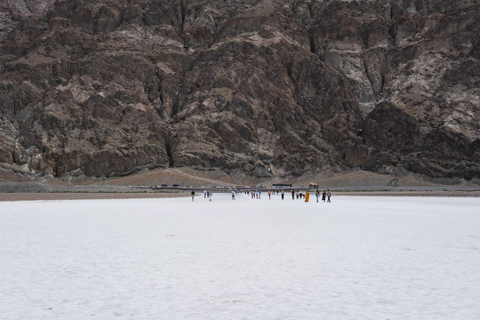
The lowest point in North America, 282 feet below sea level. Nearly 200 square miles of salt flat — mostly table salt, with calcite, gypsum and borax — crack into geometric polygons as groundwater seeps up and evaporates. Look east for the tiny "SEA LEVEL" sign on the cliff far above you, then west to Telescope Peak at 11,049 ft.
Distance
1 mi round trip to the salt flat edge
Elevation gain
Flat
Time
40 min–1.5 hr
Start / parking
Paved lot on Badwater Road, 17 mi (30 min) south of Furnace Creek
From our base
≈ 16 mi straight line

Best time: Sunrise or sunset; avoid midday in summer

Good to know
  • Polygons near the boardwalk are trampled flat — walk 15–20 min out for sharp ones.
  • Sunrise lights the Panamints; sunset lights the Black Mountains behind you.
  • Glare off the white salt is brutal even in winter — bring sunglasses.

Season note: Summer: no more than ~15 min outside the vehicle. Rare winter floods form shallow Lake Manly.

Accessibility: ADA ramp to a boardwalk over the spring pool (older boards, not level); the salt beyond is firm. Vault toilet, RV parking.
Zabriskie Point2

Zabriskie Point

ViewpointEasyNo permit
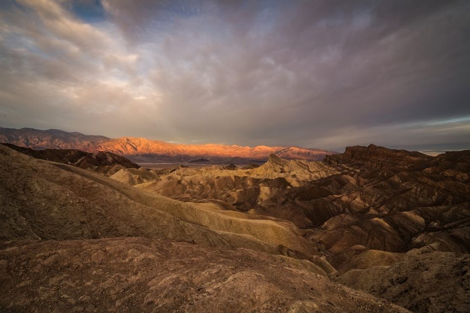
The most photographed view in the park. A short paved ramp climbs to an overlook above a sea of yellow and brown badlands carved by water that almost never falls. The jutting spine in the middle is Manly Beacon, 823 ft, named for the 49er who walked out of the valley for help. Beyond it lie the salt flats and the Panamints.
Distance
0.25 mi round trip from the lot
Elevation gain
Minimal, paved ramp
Time
30–45 min
Start / parking
Signed lot on CA-190, 15 min east of Furnace Creek
From our base
≈ 3 mi straight line

Best time: Sunrise — the classic. Sunset works too.

Good to know
  • Arrive 30–40 min before sunrise: first light hits Manly Beacon before the sun clears the range.
  • The Badlands Loop Trail starts here and links to Gower Gulch and Golden Canyon.
  • Twenty Mule Team Canyon's one-way dirt road starts just east — a 2.5-mile bonus loop.

Season note: Comfortable year-round; the lot fills 30 minutes before sunrise in spring.

Accessibility: Wheelchair accessible — the quarter-mile approach is paved, though it climbs. Bus/RV parking, vault toilet.

Artists Palette (via Artists Drive)3

Artists Palette (via Artists Drive)

Scenic driveEasyNo permit
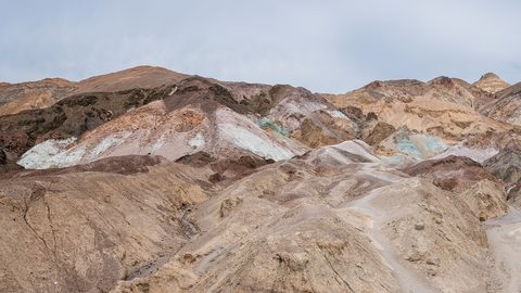
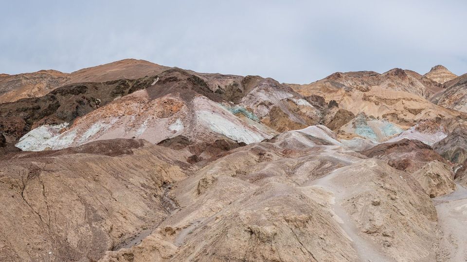
The most popular scenic drive in the park — a one-way, nine-mile paved road rollercoastering through hills splashed with red, orange, yellow, green, pink and lavender, all from volcanic deposits rich in iron oxides and chlorite. The Artists Palette pullout is the showpiece, visible from the parking area. Parts of Star Wars: A New Hope were filmed here.
Distance
9 mi one-way paved loop
Elevation gain
Rolling — dramatic dips
Time
25–45 min
Start / parking
Entrance 8.5 mi south of the Badwater Rd / CA-190 junction
From our base
≈ 6 mi straight line

Best time: Late afternoon, when the mineral colors are most saturated

Good to know
  • Drive it in late afternoon — the NPS says colors are "most dramatic during afternoon light."
  • The 25-ft length limit is real: leave the RV at camp.
  • Watch for cyclists — the dips hide them. One-way, so you cannot double back.

Season note: Open year-round. Colors go flat in harsh midday sun.

Accessibility: Doable from the car; Artists Palette is visible from the paved lot. Vault toilet.

Mesquite Flat Sand Dunes4

Mesquite Flat Sand Dunes

DunesModerateNo permit
The park's most accessible dune field, and the one that looks like everyone's mental image of a desert. Sand eroded from mountains to the north is carried by wind and trapped by mountains to the south, so the dunes stay put even as individual grains move. There is no official trail — the whole field is open for cross-country wandering.
Distance
2 mi round trip to the tallest dune
Elevation gain
185 ft
Time
1.5 hr
Start / parking
Paved lot on CA-190 just east of Stovepipe Wells Village
From our base
≈ 20 mi straight line

Best time: Sunrise or sunset for the ripple shadows; then stay for the stars

Good to know
  • Go at sunrise: overnight wind erases footprints and low light shadows every ripple.
  • The tallest dune is about a mile in — farther than it looks. Sight a landmark first.
  • Stay for the stars — one of the best dark-sky spots, right off the highway.

Season note: Sand gets dangerously hot in summer — NPS posts "hiking not advised after 10 am."

Accessibility: Paved lot with bus/RV spaces and a dune view, but no accessible surface on the sand. Vault toilets, no pets.

Furnace Creek5

Furnace Creek

AreaEasyNo permit
Not a sight so much as the park's operating system: the visitor center (8 am–5 pm, every day of the year), the only full-service fuel and groceries on the east side, The Inn and The Ranch, the campground, and the Timbisha Shoshone village. A mile west, Harmony Borax Works preserves adobe ruins and a twenty-mule-team wagon from the operation that hauled borax 165 miles to Mojave in the 1880s.
Distance
Harmony Borax Works loop 0.4 mi
Elevation gain
50 ft at Harmony Borax
Time
2–4 hr for the area
Start / parking
Furnace Creek Visitor Center, CA-190 — no street address; N 36°27.70, W 116°52.00
From our base
≈ 4 mi straight line

Best time: Any time — the visitor center opens at 8 am daily

Good to know
  • Stop at the visitor center first — rangers have today's road conditions.
  • Pay your fee here or at the 24/7 machine; there are no entrance stations on the roads.
  • Free 24-hour Wi-Fi at the visitor center — your last reliable connection for a while.

Season note: Open year-round. The world record 134°F was recorded here on July 10, 1913.

Accessibility: The visitor center is fully accessible, with assisted-listening and audio-description devices. The Harmony Borax loop is wheelchair accessible.

Dante's View6

Dante's View

ViewpointEasyNo permit
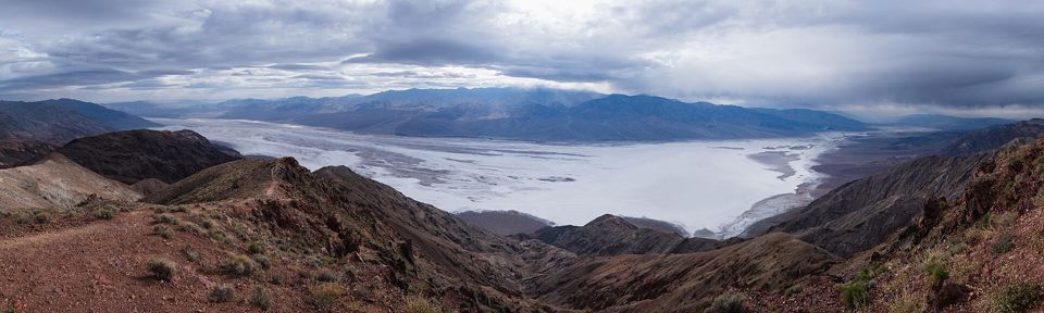
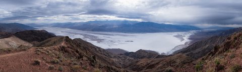
The best single overview of Death Valley, 5,575 feet directly above Badwater Basin on the crest of the Black Mountains. The whole salt pan unrolls below with the Panamints and Telescope Peak opposite. Asked in 1926 for the finest view of Death Valley, local Charles Brown said: "I don't pay much attention to scenery, but I know one view that made me stop and look."
Distance
Viewpoint at the lot
Elevation gain
None at the viewpoint; 1,200 ft to Mt. Perry
Time
45 min drive each way, 30 min at the top
Start / parking
End of Dante's View Road, 45 min from Furnace Creek
From our base
≈ 17 mi straight line

Best time: Sunrise, sunset, or after dark for the Milky Way

Good to know
  • Walk five minutes north along the ridge and you'll have the view to yourself.
  • New moon for the Milky Way; full moon when the salt flats glow white below.
  • Genuinely cold and windy — pack layers even when it's 100°F at Furnace Creek.

Season note: Around 5,500 ft, so 20–25°F cooler than the valley floor. Bring a jacket any month.

Accessibility: Wheelchair accessible viewing area at the lot, with exhibits and a vault toilet.

Golden Canyon & Red Cathedral7

Golden Canyon & Red Cathedral

HikeModerateNo permit
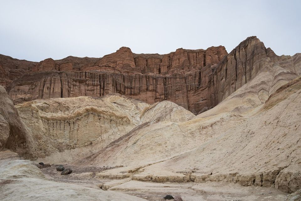
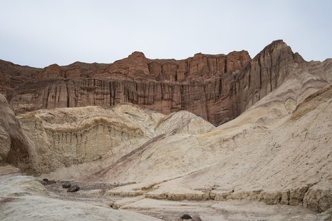
The best short hike in the park, and the easiest way to get inside the badlands you photographed from Zabriskie Point. The trail climbs a wide golden-walled wash past ripple marks fossilized in stone. Half a mile of scrambling past the junction reaches Red Cathedral, an amphitheater of fluted rust-red walls. The full 7.8-mile loop climbs to Zabriskie Point and returns via Gower Gulch.
Distance
2 mi round trip
Elevation gain
535–834 ft
Time
1.5–4.5 hr depending on route
Start / parking
Paved lot 2 mi south of CA-190 on Badwater Road
From our base
≈ 4 mi straight line

Best time: Early morning or the last two hours of light

Good to know
  • Do the 7.8-mile loop downhill: get dropped at Zabriskie Point and walk back.
  • The base hike has exactly one 3-foot rock scramble; kids handle it fine.
  • Red Cathedral means crawling through tight rock — skip it with small children.

Season note: NPS: "hiking not advised after 10 am in the summer." Do not enter if rain threatens.

Accessibility: Not accessible. Paved lot with RV spaces and a vault toilet; no pets on the trail.

Devils Golf Course8

Devils Golf Course

ViewpointEasyNo permit
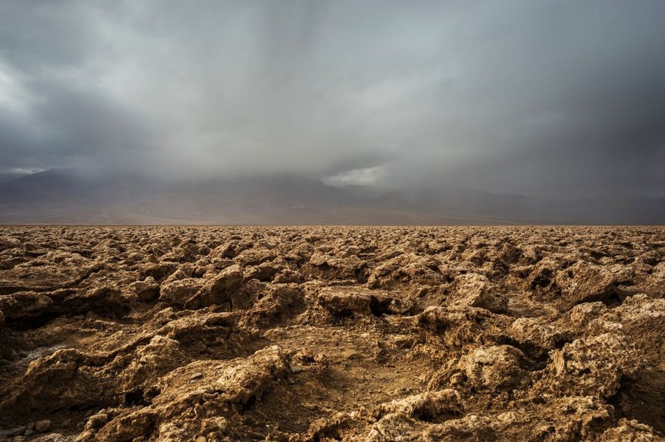
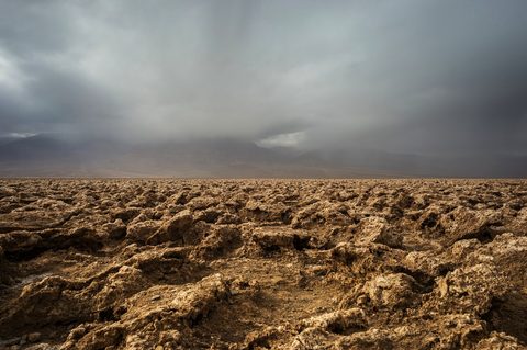
An immense field of rock salt eroded by wind and rain into jagged, ankle-breaking spires — so serrated, said an old guidebook, that "only the devil could play golf on such rough links." The real reason to stop is to switch off the engine and listen: on a hot day you can hear faint pops and pings as billions of tiny salt crystals expand and burst apart.
Distance
Roadside — view from the parking area
Elevation gain
None
Time
15–20 min
Start / parking
Short compacted-gravel spur off Badwater Road, between Artists Drive and Badwater
From our base
≈ 12 mi straight line

Best time: Any time; low sun makes the spires more dramatic

Good to know
  • Stand still and stay quiet for a minute — the crackling is the whole experience.
  • NPS says view it from the lot: the spires are razor-sharp and easily damaged.
  • Big open horizon makes this a good sunrise, sunset and night-sky stop.

Season note: Mid-May to mid-September this spot can hit 120°F or higher. Best late fall to early spring.

Accessibility: Viewable from the car; spur and lot are compacted gravel suitable for most vehicles. No trail or restroom.

Mosaic Canyon9

Mosaic Canyon

CanyonModerateNo permit
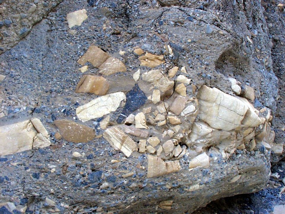
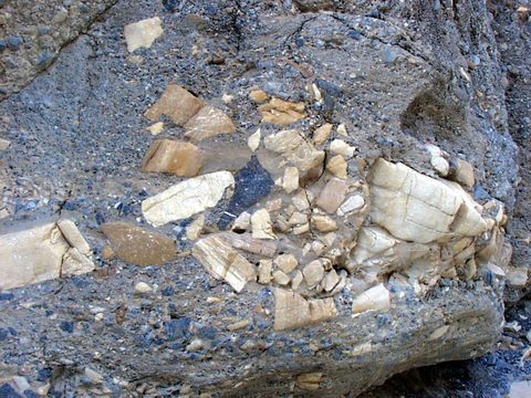
The park's best canyon walk, and it pays off within five minutes. Slick marble narrows polished to a shine by centuries of debris-laden floodwater open immediately above the trailhead. Further up, look for the mosaic breccia the canyon is named for — older rock fragments naturally cemented into a stone collage. Most hikers stop at the boulder jam 1.3 miles in.
Distance
4 mi round trip
Elevation gain
1,200 ft
Time
2.5–3 hr full; under an hour to the first narrows
Start / parking
End of the 2.3 mi unpaved Mosaic Canyon Road, opposite Stovepipe Wells Campground
From our base
≈ 21 mi straight line

Best time: Morning, while the canyon is still in shade

Good to know
  • The first half mile of narrows is the highlight — a short visit justifies the drive.
  • Wear shoes with grip: the polished marble is genuinely slippery.
  • The 2.3-mile access road is unpaved but usually fine for sedans.

Season note: NPS: "hiking not advised after 10 am in the summer." This canyon floods — skip it if rain is possible.

Accessibility: Not accessible — an unimproved canyon bottom with scrambling. Gravel lot; nearest restroom at Stovepipe Wells.

Ubehebe Crater10

Ubehebe Crater

HikeModerateNo permit
A maar volcano — molten rock met groundwater, flashed it to steam, and blew a hole in the desert roughly 2,100 years ago. The result is half a mile across and 500–777 feet deep, the layers it punched through exposed under a black mantle of ejecta. A 1.5-mile loop circles the rim; Little Hebe Crater appears half a mile along. An important cultural site for the Timbisha Shoshone.
Distance
1.5 mi rim loop
Elevation gain
500 ft
Time
1 hr on the rim; 1 hr drive each way
Start / parking
Paved lot at the crater rim, at the end of North Highway
From our base
≈ 52 mi straight line

Best time: Afternoon and sunset, when the ejecta layers show their colors

Good to know
  • Walk the rim counter-clockwise — the uphill comes first, views open gradually.
  • Exposed drop-offs throughout: not for anyone uneasy with heights.
  • No restrooms — the nearest are at Grapevine Ranger Station, 5 miles east.

Season note: Windy in every season. Do not descend into the crater in summer — the climb out is a slog in loose debris.

Accessibility: The crater is visible from the paved lot (buses/RVs fine). The rim loop is unimproved and exposed. No restrooms.

Also consider

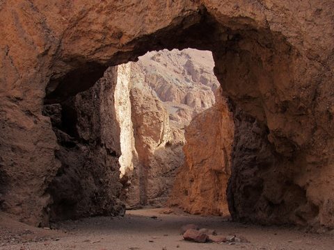
  • Natural BridgeNatural BridgeA 1-mile, 45-minute walk up a wash to a 35-foot rock span, off a 13.5-mile gravel road on Badwater Road. Easy and family-friendly; the salt-flat view on the way back is the best part. Details about Natural BridgePhoto: Jeffhollett · CC BY-SA 4.0
  • Twenty Mule Team CanyonTwenty Mule Team CanyonA 2.5-mile one-way dirt road rollercoastering through yellow badlands just east of Zabriskie Point. Usually passable in a normal car, and one of the few roads where you may walk a dog. Details about Twenty Mule Team CanyonPhoto: Alexander Hatley · CC BY 2.0
  • Titus Canyon RoadTitus Canyon RoadThe park's most popular backcountry drive — 27 one-way miles from Nevada past Red Pass, Leadfield ghost town and petroglyphs into narrows 20 feet wide. Closed for repairs October 1, 2026 – September 30, 2027. Details about Titus Canyon RoadPhoto: Fabio Achilli · CC BY 2.0
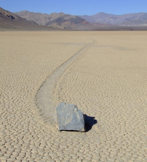
  • Racetrack PlayaRacetrack PlayaThe sailing stones and their trails across a dry lakebed. 4x4, high clearance and heavy-duty tires, no cell service, and the NPS says at least 3.5 hours each way from Furnace Creek. Details about Racetrack PlayaPhoto: Lgcharlot · CC BY-SA 4.0
  • Telescope PeakThe park's high point at 11,049 ft — 12.2 miles round trip and 3,375 ft of gain from Mahogany Flat, up a high-clearance dirt road. The right hike in summer, a snow climb in winter. Details about Telescope Peak

Photos & map

10 photos from January 2025 — same season as our trip, so this is close to what it will look like. Switch to the map to see where each one was taken alongside the Top 10.

January 2025 photos: Aaron Soto

Plan your visit

Getting there

FromRoute & timeMiles
LA / OC area via Shoshone (our route)I-15 north to Baker, then CA-127 north through Tecopa to Shoshone (last gas and store), on to Death Valley Junction, then CA-190 west straight to Furnace Creek — paved highway the whole way. NPS puts Shoshone about 1 hour from Furnace Creek.
The Badwater Road back doorFrom Shoshone, CA-178 west over Jubilee and Salsberry passes joins Badwater Road at the south end of the valley and runs north past Badwater Basin to Furnace Creek. Scenic, but the southern stretch still carries flood-damage warnings (soft shoulders, unpaved sections) — a daylight option for a day trip, not the way in with a loaded car.
LA area via Ridgecrest / TronaThe west-side approach: I-5 or CA-14 north to Ridgecrest, then SR-178 (Panamint Valley Road) through Trona to CA-190 and in past Stovepipe Wells. NPS gives Ridgecrest about 2.5 hours from Furnace Creek.

Getting around

There is no shuttle and no public transportation to or within the park. Most headline sights sit on CA-190 and Badwater Road and need nothing more than a regular car; the short gravel spurs to Devils Golf Course, Natural Bridge, Mosaic Canyon and Twenty Mule Team Canyon are normally fine for sedans, but washouts happen — ask at the visitor center.

Do not rely on GPS. The NPS warns navigation here is "notoriously unreliable." There is no street address for the park; coordinates are N 36°27.70, W 116°52.00. Download the NPS App and save Death Valley offline.

Entrance fees & passes

$30 per private vehicle, 7 days; $25 per motorcycle; $15 per person on foot or bicycle. A Death Valley annual pass is $55; the America the Beautiful pass is $80 for US residents ($250 non-residents), free or discounted for seniors, military, people with disabilities and 4th graders.

There are no staffed entrance stations — nobody stops you on the way in, so paying is on you. Buy ahead on Recreation.gov and print the pass for your dashboard; pay a ranger at Furnace Creek or Stovepipe Wells; or use a 24/7 automated machine at Furnace Creek, Stovepipe Wells, Grapevine Ranger Station, Ryan Kiosk, Zabriskie Point, Badwater, Hell's Gate or several campgrounds. Credit cards only — no cash anywhere in the park.

Reservations & timed entry

None. No timed entry and no day-use reservation system — you can drive in at any hour of any day. The only things you reserve are Furnace Creek Campground (October 15 – April 15), the designated backcountry roadside campsites, park lodges, and occasional ticketed ranger programs.

Fuel, food, water, cell

Fuel — only three stations in an area the size of Connecticut: The Oasis at Death Valley (Furnace Creek, two grades plus diesel), Panamint Springs (gasoline and diesel) and Stovepipe Wells (87-octane only, 24 hours). All are a captive market — fill up in Baker or Shoshone first.

EV charging: no DC fast chargers in the park; the nearest are in Beatty, 43 miles out. Inside, Level 2 J1772 chargers at The Inn and The Ranch (four at each, some reported out of service) and four faster Blink units at Stovepipe Wells. Never plug an EV into a Furnace Creek Campground pedestal — the NPS warns it can destroy your car and the campground system at your expense.

Water only at Furnace Creek, Stovepipe Wells and Panamint Springs. Cell service: assume none.

Furnace Creek Visitor Center: 8 am–5 pm, every day of the year — fees, ranger advice, a 20-minute film, exhibits, the Death Valley Natural History Association bookstore and free 24-hour Wi-Fi. Stovepipe Wells Ranger Station has irregular hours; call 760-786-3200. General stores at both; showers and laundry for a fee at The Ranch.

Permits

Required

Backcountry roadside camping permit (designated sites)

Required and reservable only online for the 47 designated roadside sites on Echo Canyon, Hole in the Wall, Greenwater Valley and Cottonwood/Marble Canyon roads. $10 per night, up to 6 months ahead. No walk-up option.

Official page for Backcountry roadside camping permit (designated sites)

Optional / special

Backcountry / wilderness use permit (everywhere else)

Free and recommended, not required, for all other roadside camping, backpacking and canyoneering. Get one at Furnace Creek Visitor Center, Stovepipe Wells Ranger Station or a drop box — it is how rangers know to look for you.

Official page for Backcountry / wilderness use permit (everywhere else)

Where to stay

Camping inside the park and lodging just outside it. Booking rules change; each card links to the official page and says exactly how it’s booked.

Camping

Where we’re staying

Permit dispersed

Echo Canyon Road designated roadside sites

Along the unimproved gravel Echo Canyon Road, which leaves CA-190 about 4.6 miles east of the Furnace Creek Visitor Center. Site E1 is a mile in; the rest are spaced at least half a mile apart.

Sites
9 sites on Echo Canyon Road (47 across the facility)
Cost
$10/night
Season
Year-round
Good for
High-clearance 4x4 owners wanting a private site and a black sky 15 minutes from Furnace Creek.
no waterno toiletsno shadeno generatorsexcellent stargazing
How to book
Reservable, and reservation is mandatory — there is no walk-up option. The nine Echo Canyon sites (E1–E9) belong to a 47-site recreation.gov facility, Death Valley Backcountry Roadside Camping, which also covers Hole in the Wall Road (6 sites), Greenwater Valley Road (19) and Cottonwood/Marble Canyon roads (13).

$10 per night, bookable up to 6 months ahead, year-round — though recreation.gov warns temperatures "frequently range above 100F May through September."

Vehicle requirement, as the NPS defines it: a high-clearance SUV or truck with at least 15-inch wheel rims and 8 inches of ground clearance. 4WD is "highly encouraged." Trailers, RVs and passenger cars cannot reach most sites. Each site is a bare gravel pad — no water, toilet, shade or table, and generators are banned in the backcountry.

Our site is E1, the first and easiest: one mile of graded gravel, moderate clearance. The high-clearance/4WD guidance applies to E2–E9 farther up the canyon.

Official page / booking for Echo Canyon Road designated roadside sites

Reservable + first-come developed

Furnace Creek Campground

Beside the Furnace Creek Visitor Center at 190 ft below sea level — walking distance to rangers, the store, and The Ranch's showers.

Sites
136 sites (41 in summer) — 45 tent-only, 18 full hookup, 5 group
Cost
$30–$60/night
Season
Year-round
Good for
Everyone — tents and RVs. Showers and laundry for a fee next door at The Ranch.
potable waterflush toilets (year-round)dump stationcamp storefull hookups (18 sites)no showers
How to book
The only reservable NPS campground in the park, and it works two ways by season.

Oct 15 – Apr 15 (reservable): all 136 sites go through Recreation.gov or 877-444-6777, 5 days to 6 months in advance. The NPS notes it has "booked to capacity most days" — set a reminder for the day your date opens six months out. The 18 full-hookup sites go instantly.

Late Apr – early Oct (first-come): the campground shrinks to 41 sites, some loops close, no reservations.

Fees: $30 standard; $44 full hookup ($30 site + $14 utility fee, which is not discounted, though Senior/Access holders get the site half-price); $40 and $60 group sites. 14-day annual limit.

Official page / booking for Furnace Creek Campground

First-come, first-served developed

Sunset Campground

A gravel flat across Badwater Road from the Timbisha Shoshone village, minutes from the visitor center.

Sites
230 sites
Cost
$18/night ($9 Senior/Access)
Season
Typically late fall to mid-to-late April
Good for
RVs to 60 ft and trailers to 50 ft; late arrivals with no plan. Note: no fire grates and no picnic tables at sites — campfires only at a few community grates.
potable water (seasonal)flush toilets (seasonal)dump station (seasonal)camp storeno hookups
How to book
Pure first-come, first-served — no reservations, ever. Take any open site, then pay by card at the automated machine or at the visitor center across the road. With 230 sites and almost no vegetation, the NPS says it "rarely fills" and "almost always has sites available, even in peak season" — the reliable fallback when Furnace Creek is booked out.

Official page / booking for Sunset Campground

First-come, first-served developed

Texas Springs Campground

In the hills just above Furnace Creek off CA-190 — higher, quieter and greener than the valley-floor campgrounds, with real views.

Sites
106 sites (26 tent-only)
Cost
$20/night ($10 Senior/Access)
Season
Typically late fall through mid-April
Good for
Tent campers and small rigs — RVs to 35 ft, trailers to 25 ft.
potable water (seasonal)flush toilets (seasonal)dump station (seasonal)fire grate and table at every siteno generators
How to book
First-come, first-served only. Take a site, then pay at the automated machine at the entrance or upper loop, or at the visitor center. Generators are banned throughout this campground, which is exactly why tent campers prefer it.

Official page / booking for Texas Springs Campground

First-come, first-served developed

Stovepipe Wells Campground

At sea level on CA-190, 24 miles west of Furnace Creek — beside the Mesquite Flat dunes and Mosaic Canyon, next to the general store and ranger station.

Sites
190 sites (28 tent-only)
Cost
$18/night ($9 Senior/Access)
Season
Late fall to mid-to-late April; closed in extreme heat
Good for
Anyone basing on the west side for the dunes, Mosaic Canyon and the Panamints.
potable water (seasonal)flush toilets (seasonal)dump stationcamp storefirewood and ice for saleno hookups
How to book
First-come, first-served; pay at the machine at the entrance. The NPS closes it seasonally in extreme heat. Campers can buy pool and shower passes at Stovepipe Wells Village and use its free Wi-Fi — a real perk, since no NPS campground has showers. A separate concession-run RV park with full hookups sits alongside, booked through the Village.

Official page / booking for Stovepipe Wells Campground

First-come, first-served developed

Mesquite Spring Campground

Far north of the park at 1,800 ft, 2 miles off Scotty's Castle Road below Grapevine Canyon — the best base for Ubehebe Crater and the Racetrack.

Sites
40 sites
Cost
$20/night ($10 Senior/Access)
Season
Year-round
Good for
Northern-park trips, dark skies, and anyone who wants quiet.
potable waterflush toilets (year-round)dump stationfire grate and table at every siteno hookups
How to book
First-come, first-served, open year-round — one of only three NPS campgrounds here that never closes. Take a site, then pay at the machine. Being an hour from Furnace Creek, it holds sites long after the central campgrounds fill. Approach from CA-190: access via Nevada SR-267 through Grapevine Canyon is closed until further notice with Scotty's Castle. NPS summer warning: "nightly lows in the 90s Fahrenheit."

Official page / booking for Mesquite Spring Campground

First-come, first-served backcountry

Free backcountry roadside camping (everywhere else)

Along authorized dirt roads throughout the park, in previously disturbed pullouts.

Sites
Unlimited dispersed, plus free primitive campgrounds
Cost
Free
Season
Year-round, subject to snow at elevation
Good for
Self-sufficient travelers with the right vehicle, two spare tires and a satellite messenger.
no services of any kindcarry all waterpack out everything
How to book
Free, no reservation; a free permit is recommended but not required — get one at Furnace Creek Visitor Center, Stovepipe Wells Ranger Station or a drop box so rangers know where to look for you.

The rules that matter: camp at least 1 mile down a dirt road from its junction with any paved road, in an already-disturbed spot, and more than 100 yards from any water source. Bury waste 200 yards from water or camp.

Prohibited: any paved road, pullout or parking lot; the valley floor from Ashford Mill north to 2 miles north of Stovepipe Wells; Eureka Dunes, Greenwater Canyon and historic mining sites; and a dozen-plus day-use-only roads including Titus Canyon, Mosaic Canyon, West Side Road, Wildrose Road, Skidoo Road, Racetrack Road and Big Pine Road.

Free primitive campgrounds are the other option: Wildrose (23 sites, 4,100 ft, no water), Thorndike (6 sites, 7,400 ft), Mahogany Flat (9 sites, 8,200 ft, at the Telescope Peak trailhead) and Eureka Dunes (7 sites). Emigrant is closed indefinitely after flood damage.

Official page / booking for Free backcountry roadside camping (everywhere else)

Lodging

in-park lodge$$$$

The Inn at Death Valley

Furnace Creek — at the visitor center

The historic, upscale option: a 1927 mission-style hideaway terraced into the hillside, AAA Four Diamond for 35+ years, with a spring-fed pool, palm gardens, a formal dining room and views west to the Panamints. Inn rooms plus newer casitas. Open all year; Level 2 EV chargers. Xanterra, 800-236-7916.

Examples: Inn rooms, Casitas, The Inn Dining Room

Website for The Inn at Death Valley

in-park lodge$$–$$$

The Ranch at Death Valley

Furnace Creek — at the visitor center

The family half of The Oasis, and the practical choice: renovated rooms and cottages around a town square of date palms, a spring-fed pool, casual restaurants, a saloon, general store, gas and diesel, and the pay showers and laundry campers rely on. Also the world's lowest golf course, 214 ft below sea level.

Examples: Rooms and cottages, Furnace Creek Golf Course

Website for The Ranch at Death Valley

in-park lodge$$

Stovepipe Wells Village

24 miles west of Furnace Creek on CA-190

Simpler, cheaper and better placed for the west side — the dunes and Mosaic Canyon are minutes away. Renovated air-conditioned rooms, a pool with a lift, restaurant and saloon, general store, a 24-hour gas station (87 octane only), four Blink EV chargers, and a concession-run RV park with full hookups. 760-786-7090.

Examples: Motel rooms, RV park with full hookups

Website for Stovepipe Wells Village

in-park lodge$–$$

Panamint Springs Resort

Far west side of the park on CA-190

The most low-key in-park option, on the western edge toward Lone Pine. Privately run, open all year, with resort rooms, camping and RV sites, a restaurant, and gasoline and diesel. Useful if you enter or leave via Olancha or the Panamint Valley. 775-482-7680.

Examples: Motel rooms, Cabins, Campground and RV sites

Website for Panamint Springs Resort

nearby town$–$$

Beatty, Nevada

About 45 minutes / 43 miles from Furnace Creek

The closest gateway town and the best value near the park: motels, casinos, restaurants, cheap fuel, and the nearest DC fast chargers. Rhyolite ghost town and the west end of Titus Canyon Road are right here. Enter via SR-374 over Daylight Pass.

Examples: Motels on US-95, Rhyolite ghost town, Fast charging

Website for Beatty, Nevada

nearby town$–$$

Pahrump, Nevada

About 1.5 hours from Furnace Creek

The biggest town on the Las Vegas side and the last full-service stop on the fastest route in: supermarkets, chain hotels, casinos, and the cheapest fuel you will see. Buy your water and food here.

Examples: Chain hotels, Supermarkets, Fuel

Website for Pahrump, Nevada

nearby town$–$$

Lone Pine, California

About 1 hour 45 minutes from Furnace Creek

The west-side base, on US-395 under Mount Whitney and the Alabama Hills. Motels, outfitters, and the Lone Pine Interagency Visitor Center — one of the authorized places to buy a Death Valley pass before you arrive. Ridgecrest (~2.5 hr) and Shoshone (~1 hr) are the other gateways.

Examples: Motels on US-395, Alabama Hills, Interagency Visitor Center

Website for Lone Pine, California

Safety & know-before-you-go

The handful of things that actually hurt people here, with the specific rule that prevents each one — sorted for our dates (mid January).

For our dates

critical

Water

Drink at least one gallon (4 liters) per person per day, more if active, plus salty food or electrolytes. Drinking water exists at only three places: Furnace Creek, Stovepipe Wells and Panamint Springs. Carry water for the car too — 5 gallons is the standard backcountry backup. Springs on maps may be dry or contaminated.

critical

No cell service — plan to self-rescue

The NPS says reception is "non-existent in most areas of the park" and "help may be many hours away; travel prepared to self-rescue." Download offline maps, share your itinerary, and carry a satellite messenger or PLB for anything off pavement. Dial 911 if you do find a signal.

critical

Vehicle breakdown and the single-car rollover

The NPS is blunt: "The most dangerous thing in Death Valley is not the heat — it is the single car rollover." Most deaths here are single-vehicle crashes on narrow, winding 1930s roads. If you break down, stay with the vehicle — it is shade, shelter and a bigger target. Raise the hood and mark the road with a large X. AAA often won't tow on dirt.

important

Cold nights at low elevation

Furnace Creek averages a 40°F low in January and the valley floor radiates heat away fast under clear skies — nights at an unsheltered site can dip into the 30s. Hypothermia is a winter risk here, not just heat: sleep in a bag rated to 20°F on an insulated pad, keep a hat on, and put on the puffy the moment the sun drops. The NPS weather page: temperatures fall 3–5°F for every 1,000 ft you climb, so Dante’s View (5,475 ft) can be 15–25°F colder than camp.

important

Abandoned mines

The park is riddled with old workings — gold, silver, lead, borax, talc, mercury. Never enter a mine tunnel or shaft. The NPS lists the hazards: unstable ground, hidden vertical shafts, rotten timbers, pockets of bad air and poisonous gas, and animals sheltering inside. The open adits at Leadfield in Titus Canyon are especially dangerous.

note

Driving at night and wildlife

Park roads are unlit, often unshouldered and rarely straight. Coyotes, jackrabbits and bighorn sheep move at dawn, dusk and after dark — hitting one with no cell service is a bad night. Scout night routes in daylight. Respect rattlesnakes (sidewinders live in the dunes), scorpions and black widows: look before placing a hand or foot.

note

Winter at elevation

Temperatures drop 3–5°F per 1,000 feet climbed, so Dante's View and the Panamint crest are a different world — pack a jacket even at 100°F below. Mahogany Flat (8,200 ft) is "often closed due to snowy/icy conditions"; Thorndike opens mid-April to December. Telescope Peak in winter is a snow climb, 12.2 mi and 3,375 ft.
Risks in other seasons (2)

critical

Extreme heat — the 10 am rule

Death Valley holds the world record air temperature: 134°F, July 10, 1913, and July still averages 116°F. The NPS posts one rule on nearly every low-elevation trail page: "Hiking not advised after 10 am in the summer." May–September, stay on paved roads near an air-conditioned vehicle — no more than ~15 min outside at Badwater. Confusion or disorientation is heat stroke.

important

Flash floods

Under 2 inches of rain a year is the problem — the ground can't absorb it. Never enter a canyon during a storm or when rain is forecast, even if the sky above you is clear. Floods arrive fast carrying large debris. The NPS singles out Mosaic Canyon as a frequent flash-flood site; Hurricane Hilary in 2023 destroyed roads still unrepaired in 2026.

Frequently asked

About the park in general. Trip questions are on The Trip.

When is the best time to visit Death Valley?
November through March. Winter highs run 65–73°F with cold nights — ideal hiking weather — and late October and November are arguably the best weeks of all, when the seasonal campgrounds reopen before the crowds arrive. Spring (March–May) is the most popular time and the only shot at wildflowers, but lodging and campgrounds sell out. Avoid June–August unless you are happy seeing the park from a car.
Is it safe to visit in summer?
The NPS answer is "yes, but you must be prepared and use common sense." With an air-conditioned car you can safely see most of the main sights: stay on paved roads, carry plenty of water, drink at least a gallon a day, and if your car breaks down stay with it. What you must not do is hike at low elevation — NPS posts "hiking not advised after 10 am" on every valley-floor trail. To walk in summer, go up: Wildrose or Telescope Peak.
Do I need a 4WD or high-clearance vehicle?
No, not for the highlights. Badwater, Artists Drive, Zabriskie Point, Dante's View, the dunes, Golden Canyon and Harmony Borax Works are all on pavement, and the short gravel spurs to Devils Golf Course, Natural Bridge, Mosaic Canyon and Twenty Mule Team Canyon are normally fine for a sedan.

You need high clearance and usually 4x4 for the Racetrack, the upper Echo Canyon sites and most backcountry roads; the NPS defines high clearance as 15-inch wheel rims and 8 inches of ground clearance.
Is there cell service in Death Valley?
Essentially no. The NPS says reception is "non-existent in most areas of the park." Some carriers get slow service at Furnace Creek and Stovepipe Wells, often only with roaming enabled, and the park warns to "expect zero connectivity" on holidays and busy weekends. There is free 24-hour Wi-Fi at the Furnace Creek Visitor Center and free Wi-Fi for Stovepipe Wells guests. Download offline maps first.
Where do I pay the entrance fee? There was no entrance station.
Correct — Death Valley has no staffed entrance stations, so paying is on you. Buy the pass in advance on Recreation.gov and print it for the dashboard; pay a ranger at Furnace Creek Visitor Center or Stovepipe Wells Ranger Station; or use a 24/7 automated machine at Furnace Creek, Stovepipe Wells, Grapevine Ranger Station, Ryan Kiosk, Zabriskie Point, Badwater, Hell's Gate or several campgrounds. Credit card only — the park takes no cash.
Can I get gas in the park?
Yes, at exactly three places: The Oasis at Death Valley in Furnace Creek (two grades plus diesel), Stovepipe Wells (87 octane only, no diesel, 24 hours) and Panamint Springs Resort (gasoline and diesel). All three are the only game in town for 50+ miles and priced accordingly — fill up in Pahrump, Beatty, Lone Pine or Ridgecrest first. For EVs there are no fast chargers in the park; the nearest are in Beatty, 43 miles away.
Can I camp anywhere I want?
No. Free dispersed camping is allowed only along authorized dirt roads, at least 1 mile in from any paved road, in an already-disturbed spot and more than 100 yards from water. It is banned along paved roads and pullouts, on the valley floor between Ashford Mill and 2 miles north of Stovepipe Wells, at Eureka Dunes and Greenwater Canyon, at historic mining sites, and on more than a dozen day-use-only roads. The designated sites on Echo Canyon, Hole in the Wall, Greenwater Valley and Cottonwood/Marble roads are different: $10 a night, reservation-only.
Do I need a reservation to enter the park?
No. There is no timed entry and no day-use reservation system — the park is open 24 hours a day, every day. The only reservations are for Furnace Creek Campground between October 15 and April 15 (book 5 days to 6 months ahead; it fills most nights), the designated backcountry roadside campsites, the park lodges, and a few ticketed ranger programs.